You are here:
-
Home
›
-
National parks in South Africa
›
-
Augrabies Falls National Park
›
-
Augrabies Falls National Park maps
Maps of the Augrabies Falls National Park
The Augrabies Falls National Park can be found
amidst the barren and desolate scenery of desert sand, thorny shrub and rock of the green Kalahari
region in the north of the Northern Cape Province, where the Orange river runs wide and
gently.
Many people who go to Augrabies Falls National Park are quite happy to admire the main falls and
then move on, but others enjoy to drive through the park as well as to explore its amazing
landscapes and plant life,where only the fittest and those who adapt, ultimately survive.
The map below shows South Africa with the locations of all its National Parks. The number 6 is the location of
the Augrabies National Park in the Northern Cape province.
| 1 Mapungubwe |
6 Augrabies Falls |
11 Karoo |
16 Bontebok |
| 2 Marakele |
7 Mokala |
12 Camdeboo |
17 Wilderness |
| 3 Kruger |
8 Golden Gate |
13 Mountain Zebra |
18 Knysna |
| 4 Kgalagadi |
9 Namaqua |
14 Table Mountain |
19 Tsitsikamma |
| 5 /Ai-/Ais/Richtersveld |
10 Tankwa |
15 Agulhas |
20 Garden Route |
| 21 Addo Elephant |
22 West Coast |
23 iSimangaliso Wetlands |
|
The map below shows an interactive map of South Africa, with a marker indicating the location of Augrabies
Falls National Park.
Tips for navigating the maps
- Use the zoom function to separate the markers that overlap.
- Use the plus/minus button in the left-hand bottom corner or the the scroll wheel of your mouse to
zoom in and out.
- Alternatively, put the mouse cursor on any location on the map that you want to explore and
click repeatedly with the left hand mouse button to zoom in or out, without moving the mouse.
- Moving the mouse cursor on the map with the left hand mouse button clicked in, will allow you
to move the map up and down and left and right.
- The button on the left in the title bar at the top will take you to a satellite view of the map
- The button on the far right in the title bar will take you to a larger map
- Click on the refresh button of your browser to return to the original map.
Go to
SANParks.org to view a map with an
overview of the Park showing its boundaries, including the boundary with Namibia - Click on the map to enlarge.
Go to
SANParks.org to view a map with an overview of the Park showing its internal lay-out and infrastructure, including viewpoints and areas
of interest - Click on the map to enlarge.
The map below shows the course and watershed of the Orange river, which
is the largest river in South Africa.
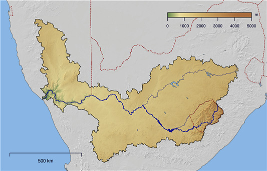
Course and watershed of the Orange river in South Africa
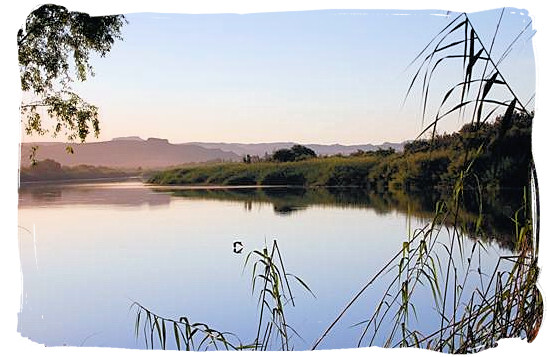
The Orange river in South Africa
Photograph by Mark Auer
Top of Page
-
Home
›
-
National parks in South Africa
›
-
Augrabies Falls National Park
›
-
Augrabies Falls National Park maps