You are here:
-
Home
›
-
National parks in South Africa
›
-
Table Mountain National Park
›
-
Table Mountain National Park maps
Map of Cape Town and the Cape Peninsula,
interactive and easy to
navigate
You will find the map of Cape Town and the Cape
Peninsula, the Cape Town street map and Detailed map of South Africa on this page, a great help in
finding your way around on the Peninsula. All of them are interactive and easy to
navigate.
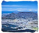
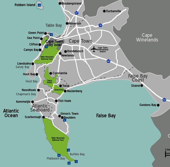
The Cape Peninsula is situated on the south-western tip of the Western Province of South Africa.
It is home to Table Mountain and the Table Mountain National Park, previously known as the Cape
Peninsula National Park.
On the map you will see it as a narrow stretch of land in the form of a bend finger, with the
city of Cape Town at its base like a knuckle.
Containing four separate sections, the Table Mountain National Park extends from Signal Hill in
Cape Town, all the way down towards the Cape of Good Hope and Cape Point at the southern tip, a
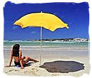
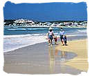
distance approximately 60 kilometres. It is beautiful, with awe-inspiring mountains, valleys and
forests surrounded by glorious sun-drenched bays and beaches.
Map of the Cape Peninsula showing the lay-out of the Table Mountain National Park
Map of Cape Town, Cape Town Street Map, Detailed Map South Africa
The maps below show the Cape Peninsula. You can zoom in and out from satellite
view to street view, really stunning. Follow the navigation instructions.
Map of Cape Town, Cape Town Street Map, Detailed Map South Africa
Map of Cape Town, Cape Town Street Map, Detailed Map South Africa
The next map below shows the Cape Town city area, zoom in to orientate yourself at
street level. You can zoom in and out from satellite view to street view, just follow the navigation
instructions.
Cape Town Street Map, Detailed Map South Africa
Cape Town Street Map, Detailed Map South Africa
Tips for navigating the map
- Use the plus/minus button in the right-hand bottom corner or the the scroll wheel of your mouse to
zoom in and out.
- Alternatively, put the mouse cursor on any location on the map that you want to explore and
click repeatedly with the left hand mouse button to zoom in or out, without moving the mouse.
- Moving the mouse cursor on the map with the left hand mouse button clicked in, will allow you
to move the map up and down and left and right.
- The button in the left-hand bottom corner will take you to a satellite view of the map
- The button in the left-hand top corner will take you to an enlarged map.
- Click on the refresh button of your browser to return to the original map.
This last map shows the whole of South Africa, just follow the navigation
instructions to explore it.
Map of Cape Town, Cape Town Street Map, Detailed Map South Africa
Map of Cape Town, Cape Town Street Map, Detailed Map South Africa
Tips for navigating the map
- Use the plus/minus button in the right-hand bottom corner or the the scroll wheel of your mouse to
zoom in and out.
- Alternatively, put the mouse cursor on any location on the map that you want to explore and
click repeatedly with the left hand mouse button to zoom in or out, without moving the mouse.
- Moving the mouse cursor on the map with the left hand mouse button clicked in, will allow you
to move the map up and down and left and right.
- The button in the left-hand bottom corner will take you to a satellite view of the map
- Click anywhere on the map to minimize the window in the left-hand top corner.
- The button in the left-hand top corner will take you to an enlarged map.
- Click on the refresh button of your browser to return to the original map.
Top of Page
-
Home
›
-
National parks in South Africa
›
-
Table Mountain National Park
›
-
Table Mountain National Park maps