Explore the 9 provinces of South Africa, they are almost
like countries within a country.
Prior to when the 9 new provinces of South
Africa, as we know them today, came into being, South Africa consisted of only 4 provinces. They
were the Transvaal and the Orange Free state, previously Boer republics and Natal and the Western
Cape Province, which were once British colonies.
Strewn across the country there were also the apartheid "homelands", kind of
artificial states based on tribal identity, to which the black people were forced to have
citizenship and relinquish their South African citizenship.
The change came about in 1994, after South Africa's first free national
elections and subsequent transition to a new and free democracy.
The new democracy also brought a change in the administrative structure of
the new provinces. Together with a large degree of self-government, each province received its
own legislature, executive council and premier.
South Africa,s rainbow culture shows in the incredible diversity between
these new provinces, almost like separate countries within a country, each one unique with its
own characteristics and dynamics.
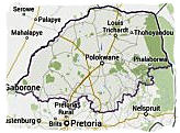
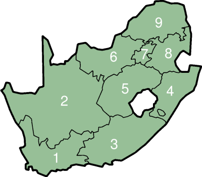
Let us go and visit them, just click on the province of your
choice in the menu below. The numbers correspond with those on the map underneath the menu.
Click anywhere on the map to clear the "Directions" window
The button in the left-hand top corner allows you to select a larger version of the
map.
The button in the left-hand bottom corner allows you to change from street map to satellite
view and vice versa.
The plus/minus button in the right-hand bottom corner allows you to zoom in and out. You
can zoom in to a detailed street map of any city or area that you select.
Alternatively, put the mouse cursor on any location on the map that you want to explore and
click repeatedly with the left hand mouse button without moving the mouse.
Moving the mouse cursor on the map with the left hand mouse button clicked in, will allow you
to move the map up and down and left and right.
Click on the refresh button of your browser to return to the original map.
Languages: 49.7% Afrikaans, 24.7% isiXhosa, 20.2% English
Population: 5 822 734 (2011)
Share of SA population: 11.3%
Area: 129 462 square kilometres
Share of total area: 10.6%
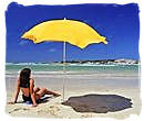
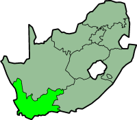
The Western Cape Province is known as a place of great splendour and natural
beauty. Boasting a fantastic climate and extraordinary scenic beauty, combined with some of the
world's greatest beaches, a remarkably rich history, a fabulous food and wine culture and
wonderful people, this province offers almost everything you can wish for as a tourist.
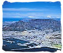
Towering majestically over the city of Cape Town or the "Mother City" as
local South Africans fondly like to call it, is the world renowned Table Mountain, a spectacular
backdrop to this beautiful city and the whole of the Cape Peninsula.
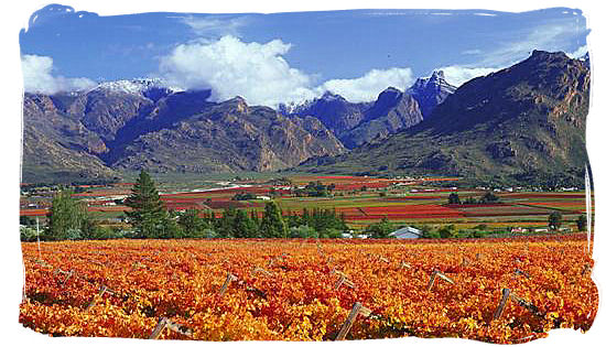
White sun-drenched beaches, endemic forests of ancient trees, nature reserves and
beautiful valleys with vineyards and orchards between rugged mountains forming the scenic
background to art festivals, craft markets and historical buildings, await those who come explore
this province.
Great experiences like tasting our famous wines right there where they grow,
watching whales and dolphins rollick in the sea, riding ostriches, swimming with penguins,
standing in Nelson Mandela's prison cell, watching Jaws the awesome great white shark from an
underwater cage and taking the cable way to the top of Table Mountain, will make your visit
absolutely out of this world.
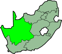
Those who love the rough and arid countryside of the Northern Cape Province,
call it the jewel of South Africa. Looking at it makes one wonder what it is that holds so much
fascination for them. But after a while one realizes that there is more than meets the eye and
that the first impression of a desolated ancient land only goes surface deep.
Northern Province certainly has its own unique attractiveness amid the other
South African provinces. Below that seemingly desolate surface great riches is has been found in
the form of large deposits gem stones such as topaz, opal, garnet, jasper, rose quarts, agate and
last but certainly not least, diamonds. Which is why it is often named the jewel province.
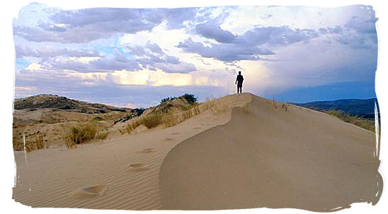
Above ground on its surface the province is home to awesome wildlife and scenery
richness such as: Vast open plains and rust-red dunes tinted in the golden tones of the sun with
roaming herds of antelope and the annual springtime explosion of brilliantly coloured flowers in
Namaqualand.
It is also home to four of South Africa's 20 national parks featuring a wide
range of wild life including the Big 5 and Last but not least the mighty Orange river in the north
with its famous Augrabies falls, the world's sixth largest waterfall.
Wildlife tourists, 4 x 4 enthusiasts, divers, river rafters and Hikers will
be eager to grasp the chance to discover the unspoilt river, sea and dunes, becoming totally
enthralled with the Northern Province in the process.
Languages: 78.8% isiXhosa, 10.6% Afrikaans, 5.6% English
Population: 6 562 053 (Census 2011)
Share of total SA population: 12.7%
Area: 168 966 square kilometers
Share of total SA area: 13.9%
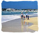
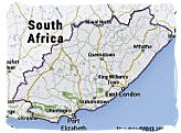
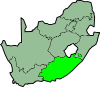
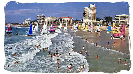
Fun in the sun along 800 kilometres of glorious and exotic Indian ocean beaches
is what the Eastern Cape Province has to offer as one of its major attractions. Starting at the
Tsitsikamma National Park, it extends all the way up the golden sunshine coast, which includes
Jeffrey's Bay, St. Francis Bay and Algoa Bay, continuing along the wild coast to Port Edward.
The long expanses of sun-drenched beaches interrupted by rocky coves and
secluded lagoons makes it a paradise offering the perfect wave to surfers, king-size catches to
anglers and glorious sunshine to holiday makers from all over the world.
For those who are in the mood for something different, the Eastern Cape is also
home to a number of great national parks where one can view a variety of wildlife, including the
Big Five, in a natural and malaria free environment. Some of the other provinces of South Africa
are not entirely malaria free.
If history and culture appeal to you, then you will find that visits to Nelson
Mandela's place of birth Qunu, the rock painting sites of the ancient Khoi Khoi people, the 19th
century town of Graaf-Reinet with its close by Valley of desolation and the historic Anglo-Boer
war battle grounds, are no doubt hot items that will make your visit to the Eastern Cape province
a memorable one.
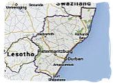
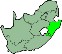
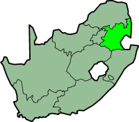
When you visit the Zulus on their home ground amid the kraals, original
dwellings and burial sites in the Zulu Kingdom in the north, you will feel the beating heart of a
proud nation. Like the other provinces of South Africa, Kwazulu Natal with its lively and striking
contrasts is a melting pot of Indian, European and Zulu cultures.
The east coast which extends further upward from Port Edward to the national
border with Mozambique is part of the Kwazulu Natal province. Because of the subtropical lush and
green environment it is often called the garden province.
In and around Zulu land one finds the legendary battle sites of the Anglo-Zulu
and Boer-Zulu wars, where history makes you think and reflect at the exact places where Zulu
warrior, Boer guerrilla and British soldier either died or survived during their heroic three-way
battle for dominance.
The province's subtropical paradise coast with its golden sand beaches and
warm Indian ocean waters, offers many leisure activities such as snorkeling, scuba diving,
swimming, angling or just relaxing in the sun.
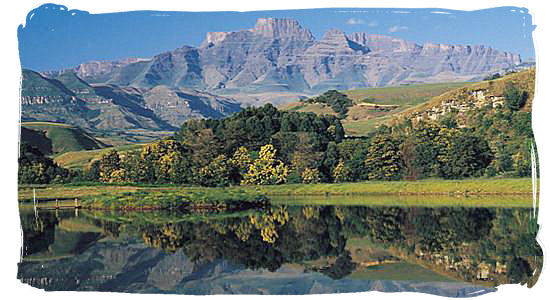
Kwazulu Natal is home to two of our four world heritage sites, the greater St
Lucia National Park and the uKhahlamba Drakensberg Park with its impressive and magnificent
mountain scenery.
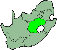
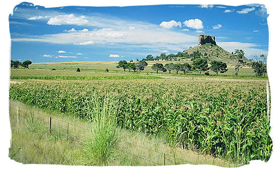
Coming across the Orange river into the Free State, the vista that will unfold
in front of you is one of immense grassy savannas and never-ending fields of maize, sunflowers
and wheat, dotted with windmills and farmsteads.
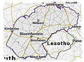
Free State province is known as the granary province of South Africa. Embraced
by several of the other provinces of South Africa, the Free State province is situated between
the Vaal river at its northern boundary and the Orange river at its southern boundary, in the
middle of South Africa. Home to more than 30,000 farms, producing more than 70 % of grain and
corn consumption, it is locally known as South Africa's bread bin.
The scenic beauty of the eastern highlands reaches a climax when you come to the
Golden Gate National Park with its spectacular sandstone formations, an area of extraordinary
scenic beauty.
Close to 340 days of sunshine per year makes this province a haven for outdoor
enthusiasts, offering activities such as game viewing, mountaineering, horse riding, 4 x 4 trail
and mountain biking, to name a few.
The dams and rivers provide many water sport opportunities, like angling,
river rafting and canoeing. From the major cities to the rural village townships, the friendliness
and hospitality of the people are overwhelming.
The province boasts two of South Africa's major national wildlife parks, the
Pilanesberg national park and the Madikwe game reserve, worlds of endless African savannah and
breathtaking wildlife scenery.
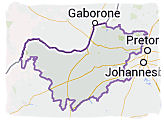
North West province,...the platinum province. Aptly named, because this member
of the nine provinces of South Africa produces more platinum from its rich resources than any other
single area in the world. For those drawn to the Africa wilderness, North West is all about the
authentic African bushveld experience, with its all year-round sunshine and hot dry African
climate.
A journey through the wild Pilanesberg mountains brings you into the bowl of
the crater of an extinct volcano, where you will find one of our country's world renowned
attractions.
Known as Sun City and Lost City, they are South Africa's answer to Las Vegas, a
fabulous resort complex in the middle of an uncultivated African savannah landscape where the Big
Five are roaming.
The province is also home to a well known World Heritage site called the
Sterkfontein cave complex, also known as the Cradle of Mankind. An abundance of hominid fossil
remains were found here, dating back up to more than 2 million years according archaeologists.
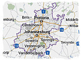
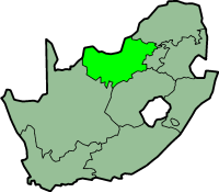
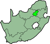
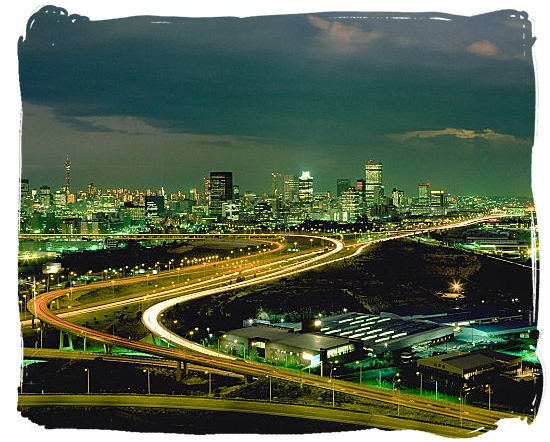
Gauteng province - Place of gold. In 1886 an unemployed miner stumbled upon a
stone bearing traces of gold. It started the Witwatersrand gold rush. The history of gold in South
Africa became the history of Gauteng.
Gold rush shantytowns developed into some of Africa's largest metropolitan
cities; Johannesburg, the capital of the province, Soweto, the heart of the freedom struggle,
Pretoria, the administrative capital of South Africa, and the Vaal Triangle, an industrial
heartland. Together they form the small and densely populated province of Gauteng, the Sesotho word
for "place of gold".
With its high population density and economic wealth Gauteng is the economic
heart of South Africa and a renowned shopping Mecca, offering some of the world's best shopping in
the southern hemisphere. Although it is the smallest, richest, loudest and most urbanized of all
the provinces of South Africa, you will find a wide variety of holiday destinations.
It is home to the famous world heritage site known as the Cradle of Humankind
at the Sterkfontein cave complex. A wealth of hominid fossils were found here, dating back more
than two million years according to archaeologists.
Last but not least the province is also home to the old mining town of Cullinan,
where the world's largest diamond, the Cullinan diamond of 3106 carats was found.
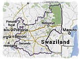
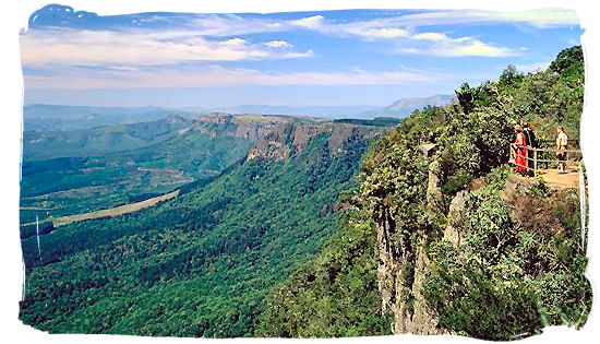
Mpumalanga is blessed with the spectacular Northern Drakensberg escarpment with
its sheer cliff faces plunging straight down to the Lowveld, nearly a 1000 meters below.
Extraordinary impressive, compared with the other provinces of south Africa.
Mpumalanga province, the place of the rising sun, when one translates it from
the local SiSwati language into English. This province with the sheer splendour of its immense
natural beauty and some of South Africa's most diverse and vibrant cultures, has it all. From one
of the most exhilarating wildlife areas in Africa, to spectacular mountain retreats, ancient ruined
cities and villages and wild water sports.
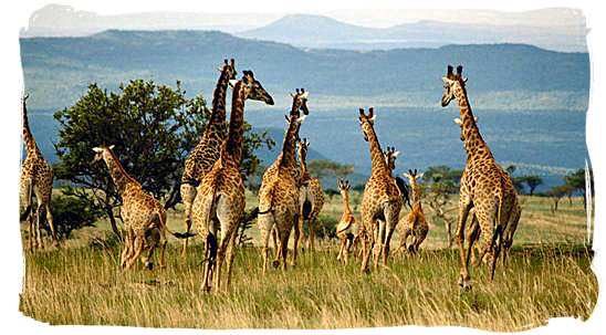
Its lowveld African savannah landscape is known as one of Africa's most
astonishing and exciting wildlife and game viewing areas, with many wildlife reserves, provincial
and national parks, including the southern half of the famous Kruger National Park.
The province is also home to vast forestry plantations of exotic trees such as
pine, gum and wattle that cover the mountain slopes.
It is rich in history with a legacy of historical well preserved gold rush towns and the
Sudwala caves with their astonishing archaeological discoveries, to name but a few. Mpumalanga will
fulfill anyone's dream of the true and genuine African experience.
Limpopo province, the great north. This province is named after the Limpopo
river that forms its western and northern boundary. Looking further than the first impression of an
endless landscape sweltering in the heat of the African sun, you will discover the great natural
splendour of the African bushveld together with its extraordinary wildlife population.
Limpopo houses a large number of game farms, private and provincial game
reserves, adjoining the northern part of the renowned Kruger National park at its eastern
border.
The Africa experience of game viewing and tracking the Big five is absolutely
fantastic here, probably the best of all the nine provinces of South Africa.
Then there are the famous hot spring resorts where one can have the heat
quenched and the muscles softened in the tranquilizing consolation of warm mineral baths. For those
people who would like to experience the real Africa atmosphere, Limpopo province is the place to go
to.
But there is more. There are the cultural and historical heritage sites in the
Makapans valley ranging in age as far back as three million years according to the scientists - The
land of the mysterious Rain Queen Modjadji, with her extraordinary rainmaking powers - and ancient
indigenous forests and great mountain ranges rising up from the endless expanses of bushveld
wilderness.