You are here:
-
Home
›
-
National parks in South Africa
›
-
Agulhas National Park
›
-
Tip of Africa
The most southern tip of Africa at Cape Agulhas,
there where Africa ends.
The most southern tip of Africa can be found in
the Agulhas National Park at cape Agulhas in South Africa.
As a tourist attraction it draws thousands of local and international tourists each year to
witness the Indian and Atlantic oceans splashing together.
Many of them where led to believe that Cape Point, the southernmost tip of the Cape Peninsula,
is the place to go, to witness this supposed natural phenomenon.
However, the residents of Cape Agulhas with most of the South Africans and scientific
institutions on theirside, disagree.
They are right when they argue that the correct longitude where the Indian and Atlantic Oceans
meet, was demarcated by the International Hydrographic Organisation (IHO), which describes the
western boundary of the Indian Ocean as follows;
From the coast of the Antarctic continent northwards, along the meridian of 20°E to Cape Agulhas
(34°50’S – 20°00’E), the southern extremity of the Republic of South Africa, in Africa (the common limit
with the South Atlantic Ocean).
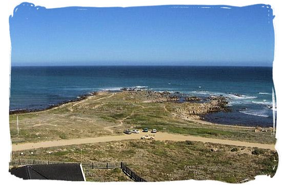
View from the Agulhas lighthouse at the most southern tip of Africa at Cape Agulhas
So those who travel to Cape Point, or the Cape of Good Hope, in the hope of seeing the confluence of two
oceans, will have to travel a little further south and east to Cape Agulhas, a distance of approximately
200km. And for those who still try to pursue the debate for commercial reasons, they do not seem to have
much of a leg to stand on.
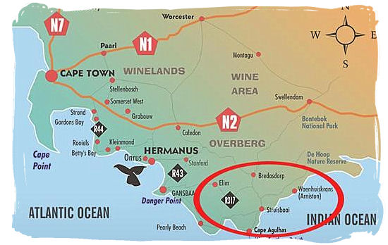
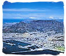
Location of the Agulhas National Park and the most southern tip of Africa at Cape Agulhas
The Hydrographic Office of the South African Navy accepts the findings of the IHO regarding the common
boundary of the Atlantic and Indian Oceans, while the Department of Oceanography at the University of Cape
Town also accepts and applies the 20°E dividing line.
The map below the location of Agulhas National Park at the the most southern
tip of Africa.
Tips for navigating the map
- Use the plus/minus button in the left-hand bottom corner or the the scroll wheel of your mouse to
zoom in and out.
- Alternatively, put the mouse cursor on any location on the map that you want to explore and
click repeatedly with the left hand mouse button to zoom in or out, without moving the mouse.
- Moving the mouse cursor on the map with the left hand mouse button clicked in, will allow you
to move the map up and down and left and right.
- The button on the left in the title bar at the top will take you to a satellite view of the map
- The button on the far right in the title bar will take you to a larger map
- Click on the refresh button of your browser to return to the original map.
Top of Page
-
Home
›
-
National parks in South Africa
›
-
Agulhas National Park
›
-
Tip of Africa